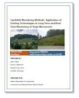
Various landslide monitoring techniques were applied concurrently to a known cut-slope landslide and a previously unknown fill slope failure, both on the Ozark Mountain Highroad (Missouri Route 76) near Branson, Missouri. Both subsurface and drone-based monitoring techniques were employed so that the strengths and weaknesses of the various monitoring techniques could be compared. Slope inclinometer casings and vibrating wire piezometers were installed at the three borings drilled in the project area. An in-place inclinometer was installed in one boring to demonstrate the effectiveness of instrumented landslide monitoring. Dataloggers were connected to a cellular modem to enable real-time monitoring of the instruments through a web-based interface. LiDAR data was collected by drone annually. The research team developed a subsurface geometry for both slides and identified movement triggering events. The team also compared the various monitoring techniques to provide guidance for future selection of long-term monitoring methods at other unstable slopes.
Report number: cmr 23-002
Published: February 2023
Published: February 2023
Project number: TR202016
Authors: Aine E. Mines, Darren L. Beckstrand, and Michael D. Bunn
Authors: Aine E. Mines, Darren L. Beckstrand, and Michael D. Bunn
Performing organization: Landslide Technology, Inc.

No comments:
Post a Comment
Note: Only a member of this blog may post a comment.